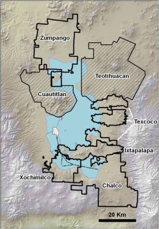
Since 2006 research funding provided by the National Science Foundation has been used to build a GIS (Geographic Information Systems) database for prehispanic settlement patterns in the Basin of Mexico. Archaeological surveys conducted in the Basin of Mexico around Mexico City from 1966-1975 by Jeffrey Parsons and Richard Blanton located 2,072 archaeological sites dating from 1200 BC — AD 1521. Today most of those sites have been destroyed. Original site information along with environmental data on soil productivity and rainfall are being compiled into a Geospatial database to retest models of cultural developed based on agricultural intensification proposed for this region since the 1970s. This project is part of Penn State’s ongoing efforts to build a broad Geospatial data base for prehispanic settlement within Central Mexican highlands. Training is available within the department for introductory and advanced geospatial research and analysis.